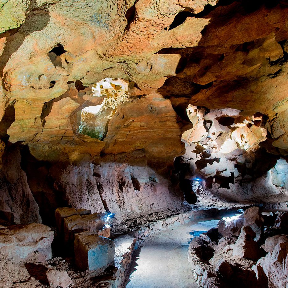
The cavity called Coves de Sant Josep has been known and inhabited by humans for around 17,000 years. This is demonstrated by the archaeological sites found at its entrance, from paintings dating from the Magdalenian period to engravings on the rocks. The site is declared a Site of Cultural Interest and UNESCO World Heritage.
Before the advances of the 20th century, important historians such as J. Cavanilles, Sebastián Miñano, or Pascual Madoz, already cited in their works on geography the existence of this cavity.
Cavity known for about 17,000 years. The existence of an Iberian settlement indicates that the cave was also known and explored at that time, just as during the Roman period, in view of a found headstone dedicated to Ciao Cneo Craso, son of the Roman consul Marco Licinio Craso.
The naturalist Josep Cavanilles, in the late eighteenth century, in his “Observations on Natural History, Geography, Agriculture, Population and Fruit of the Kingdom of Valencia” (pages 115-116 Vol I) says “… have been used for irrigation the waters that are born by the root of the Cerro de San Josep … at noon and almost at the level of the rambla or Belcaire river, which runs on its right, has two caves that communicate … even in very dry seasons a cubic foot of water comes out … ”
There are references from the XIX century on the habit of concentrating the residents around “La Font de San Josep” due to the festivity of the “Festa de les Flors” (party of the flowers), being the most daring ones usually going into the cave.
It was not until 1902, when the first known exploration of Coves de Sant Josep was carried out. In this exploration, in which two groups competed to see who was able to go deeper, the “Boca del Forn” was reached. A young man from the group almost lost his life when trying to access this mouth of the fron, since it was a place that marked the limit of the accessible part of the cave.
During the following years the interest to know and discover the cave grew, to go deeper. In 1915 the prestigious historian Carlos Sarthou Carreres made a partial exploration.
In 1926, a group of residents managed to overcome the “Boca del Forn” and reached the “Lake of Diana”, later finding the “Siphon Gallery” as an insurmountable obstacle. In 1929 Herminio Arroyas Martinez, a resident of Vall d´Uixo, died trying to overcome the gallery of siphons.
After this, in the following years, attempts to condition the cave begin to facilitate visits. Thus, footbridges are installed on the sides of the cave, above the waters. In addition, the cave is also electrified at that time, facilitating visits.
In 1936, as reported by the journalist of the Heraldo de Castellón, J. Javieres, the footbridges were replaced by boats, building a small water dam that would maintain the water levels while some steps were dredged.
Already in 1950, through holes, the “Boca de Forn” was enlarged, which is no longer the limit of the route. What allows the passage of the boats.
The first exploration carried out by a group of cavers was in 1954, by the Valencia Hiking Center, and in 1958, said group made the first topographic map of the cave.
In 1960, Joaquín Saludes, from the Valencia Underwater Research and Activities Center, with the intention of verifying the continuity of the cave, surpasses the “Galería de los Siphones”. On April 14, 1961, dynamite blasting opened this passage.
This is how the “Blue Pond” and the other galleries that make up the current route are exposed. The “Dry Gallery” is discovered, which will be accessible to the public in 1973, and a new topographic study is carried out.
In the following years (1971-1975) new galleries and siphons were discovered, reaching 2348 meters.

